I will divide the Tikal posts in two parts. Ruins and Nature. Otherwise my phone wont be able to load them and its also not nice if the posts get too large.
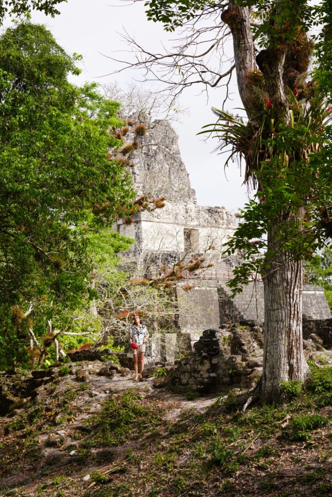
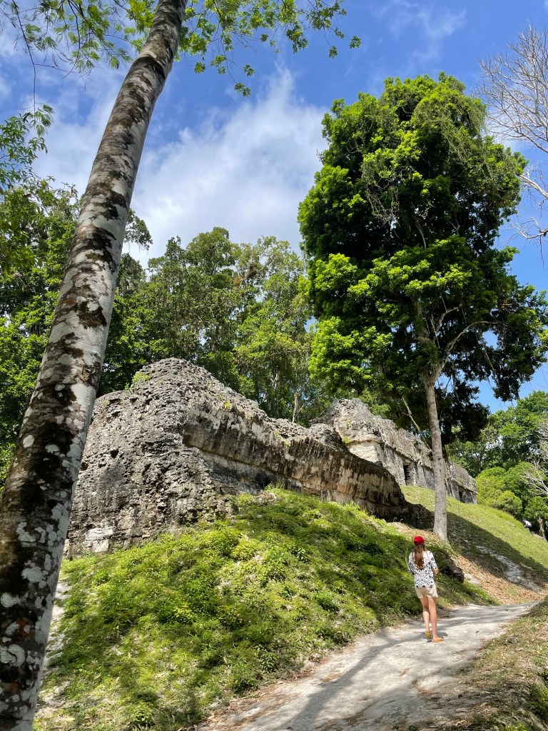
Lu and i got up very early so we could enter the park exactly at 6am. This was a very good idea since we did not see any other people for 3 hours or so. I was excited like a little kid, i have always wanted to come here! Lu also got excited , both excited!

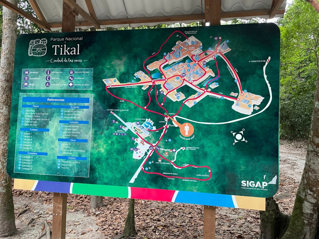
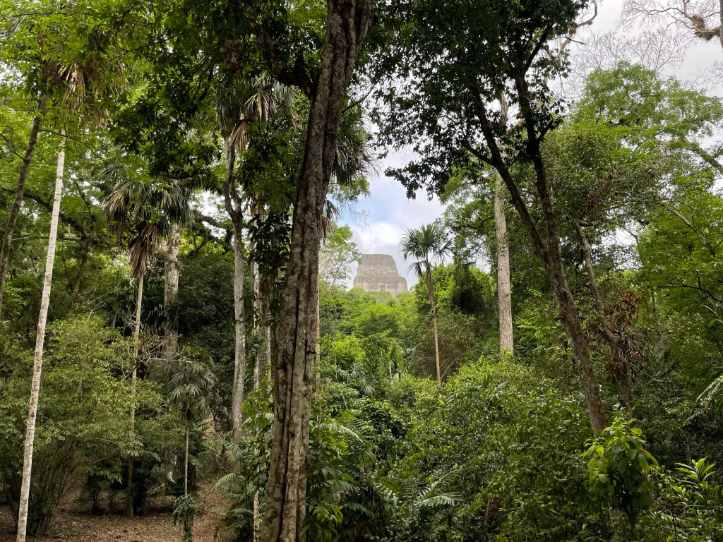
Tikal, city and ceremonial centre of the ancient Maya civilization. The largest urban centre in the southern Maya lowlands, it stood 30 km north of Lake Petén Itzá in what is now the northern part of the region of Petén in a tropical Rainforest. Uaxactún, a smaller Maya city, was located about 20 km to the north. The Tikal ruins are the central attraction of Tikal National Park, which was established in the 1950s and designated a Unesco World Heritage site in 1979.
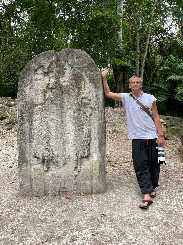
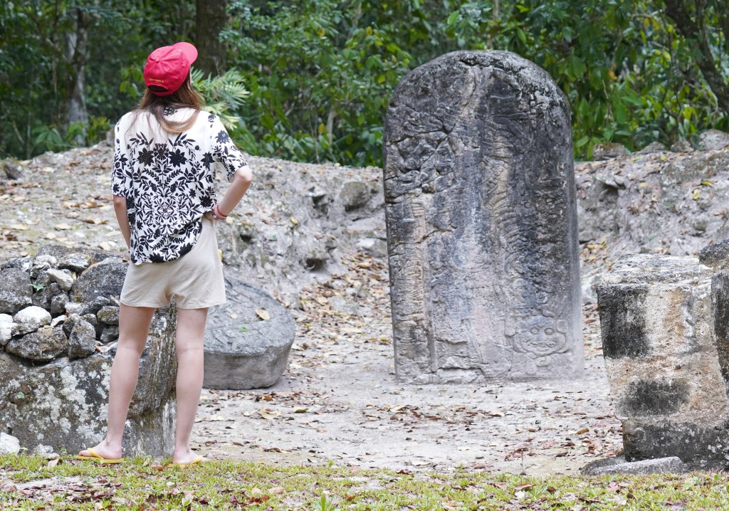
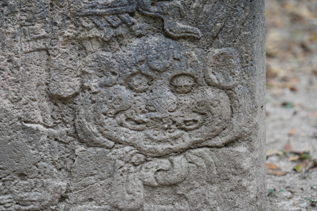
Like many Maya centres of the southern lowlands, Tikal was first occupied as a small village in the Middle Formative Period (900–300 BCE); subsequently, in the Late Formative Period (300 BCE–100 CE), it became an important ceremonial centre with the construction of major pyramids and temples. Its heyday, however, came in the Late Classic Period (600–900 CE), with the planning and construction of its great plazas, pyramids, and palaces, the appearance of Maya hieroglyphic writing and complex systems of time-counting, and the flowering of Maya art as seen in monumental sculpture and vase painting. The numerous dedicatory stelae at the site date from the 3rd century CE until the close of the 9th century. Such stelae, usually bearing the carved features of a priest or other important person, are inscribed with hieroglyphs and dates.
In the Early Classic Period (100–600 CE), Tikal was an important post in the great trading network that the contemporaneous central Mexican city of Teotihuacan had established in southern Mesoamerica. Tikal continued to flourish after the decline of Teotihuacán and probably extended its hegemony over a large part of the southern lowlands in the Late Classic Period. Between 600 and 800, Tikal reached its architectural and artistic peak, after which a decline set in, with depopulation and a general artistic deterioration. The last dated stela at the site is placed at 889. Small groups continued to live at the site for another century or so, but Tikal, along with the other Maya centres of the southern lowlands, was abandoned by the 10th century.
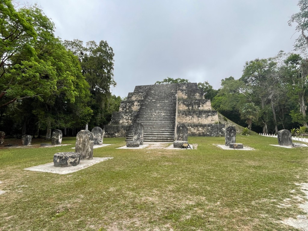
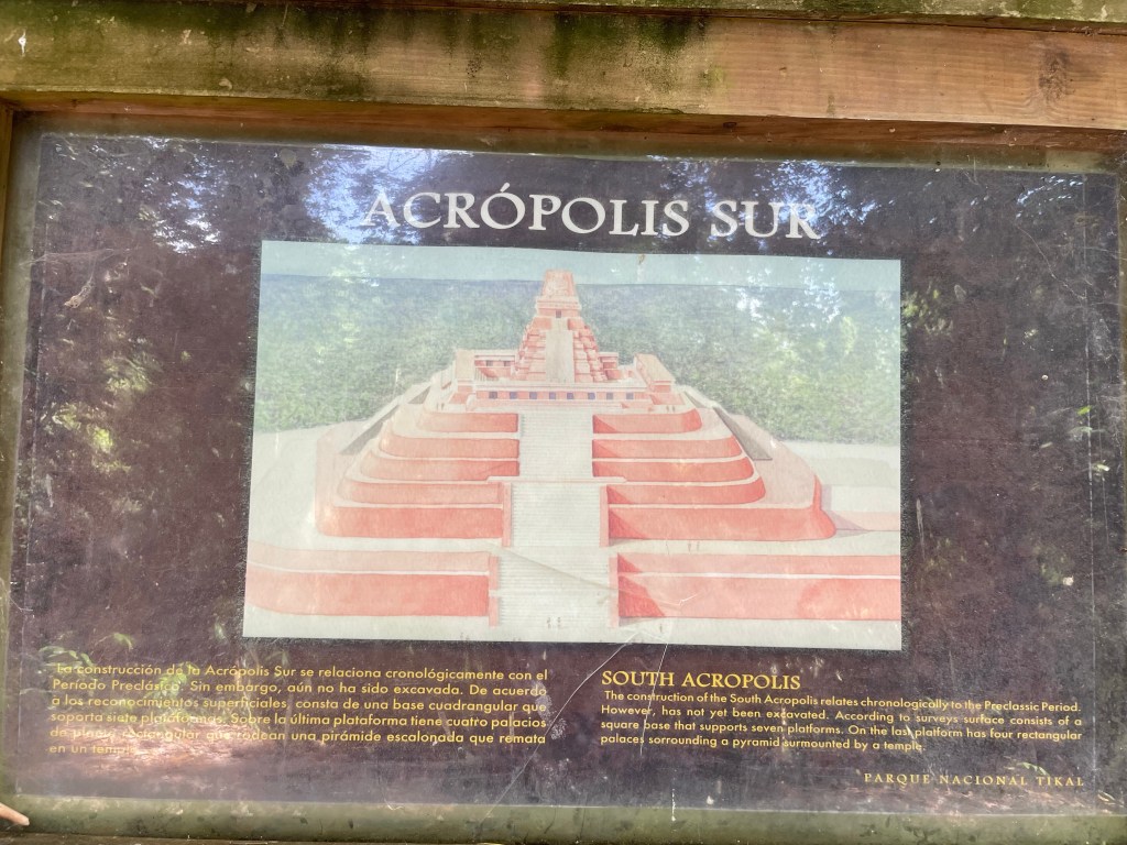
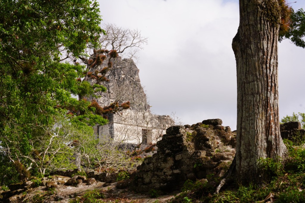
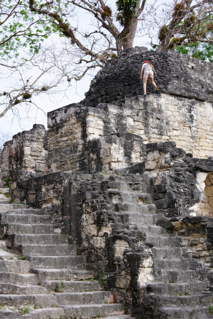
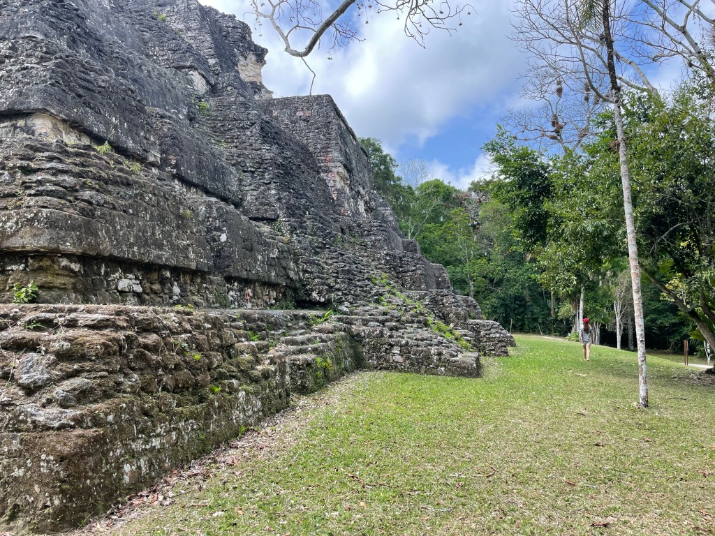
It is really crazy how overgrown some of these structures were. This sign gives you an idea. Imagine how much there still is to uncover w
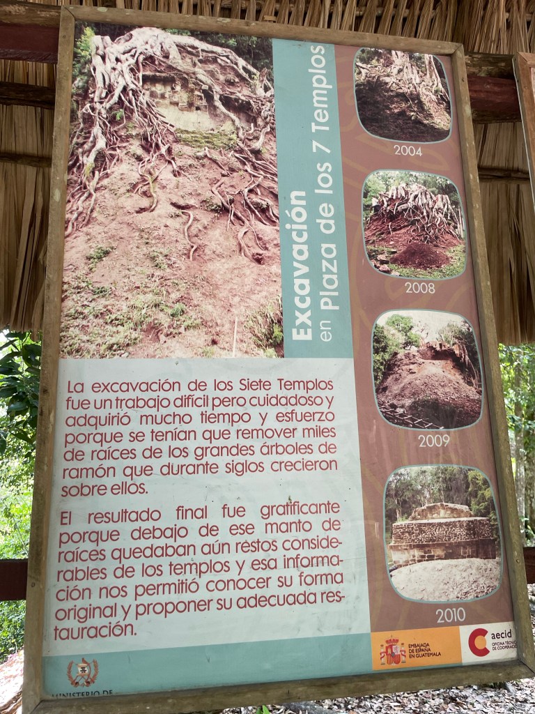
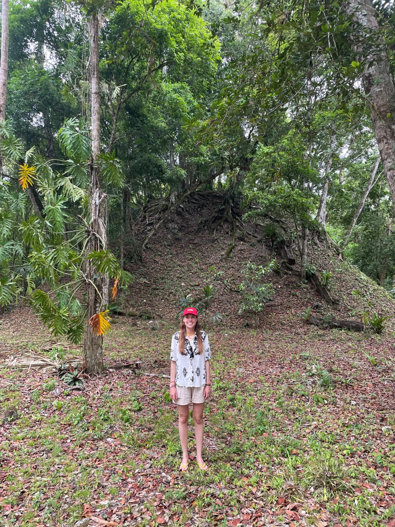
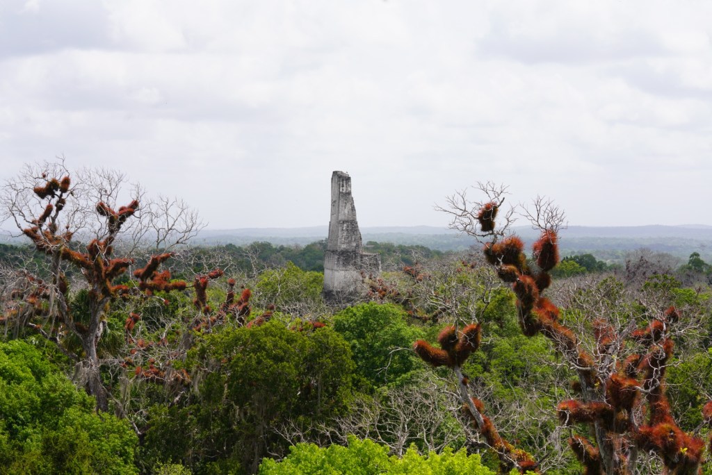
And some of the very big ones are not even dug out yet.
The main structures of Tikal cover approximately 2.5 square km. Surveys in a larger area, encompassing at least 15.5 square km, have revealed outlying smaller structures that were residences. These, however, were not arranged in streets or in close-packed formation, as in the case of Teotihuacán, but were rather widely separated. It is estimated that at its height (c. 700) the core of Tikal had a population of about 10,000 persons but that the centre drew upon an outlying population of approximately 50,000.
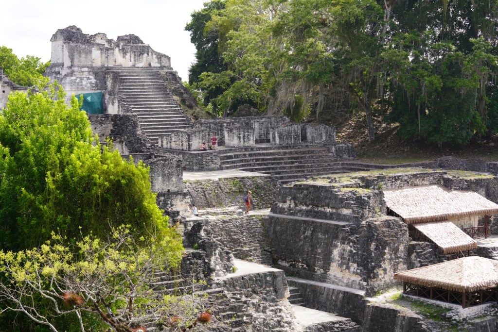
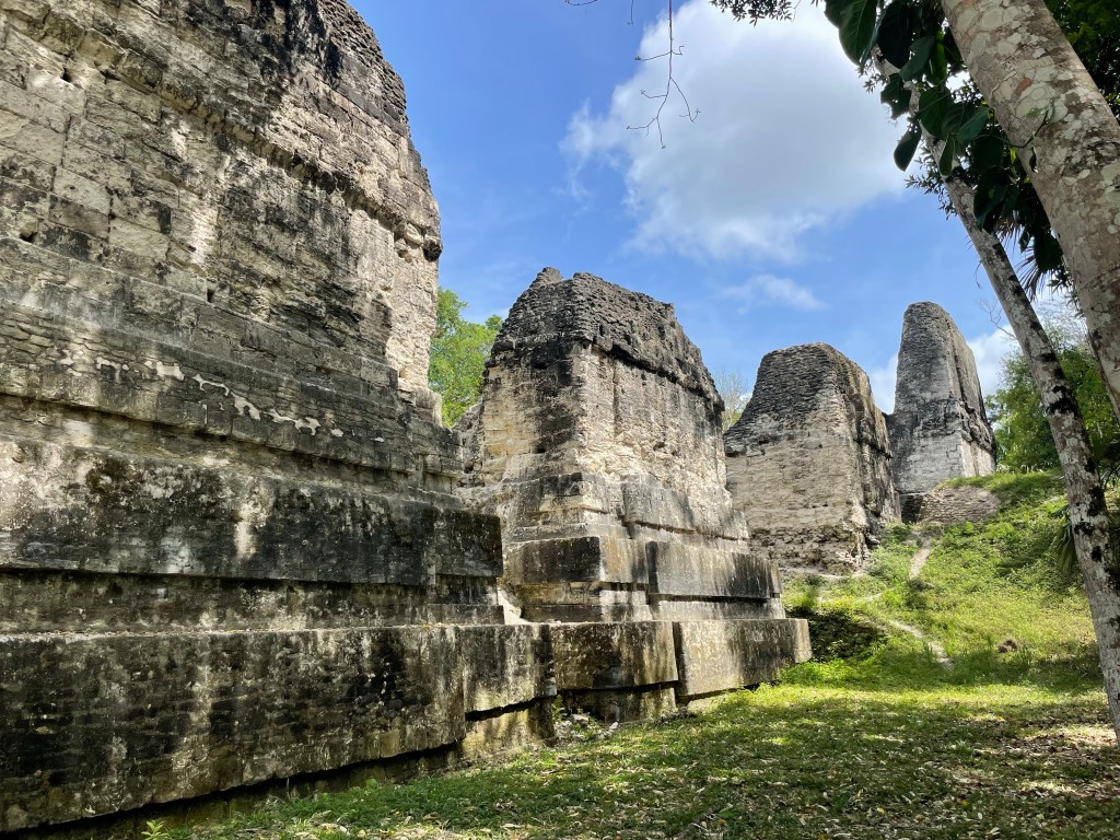
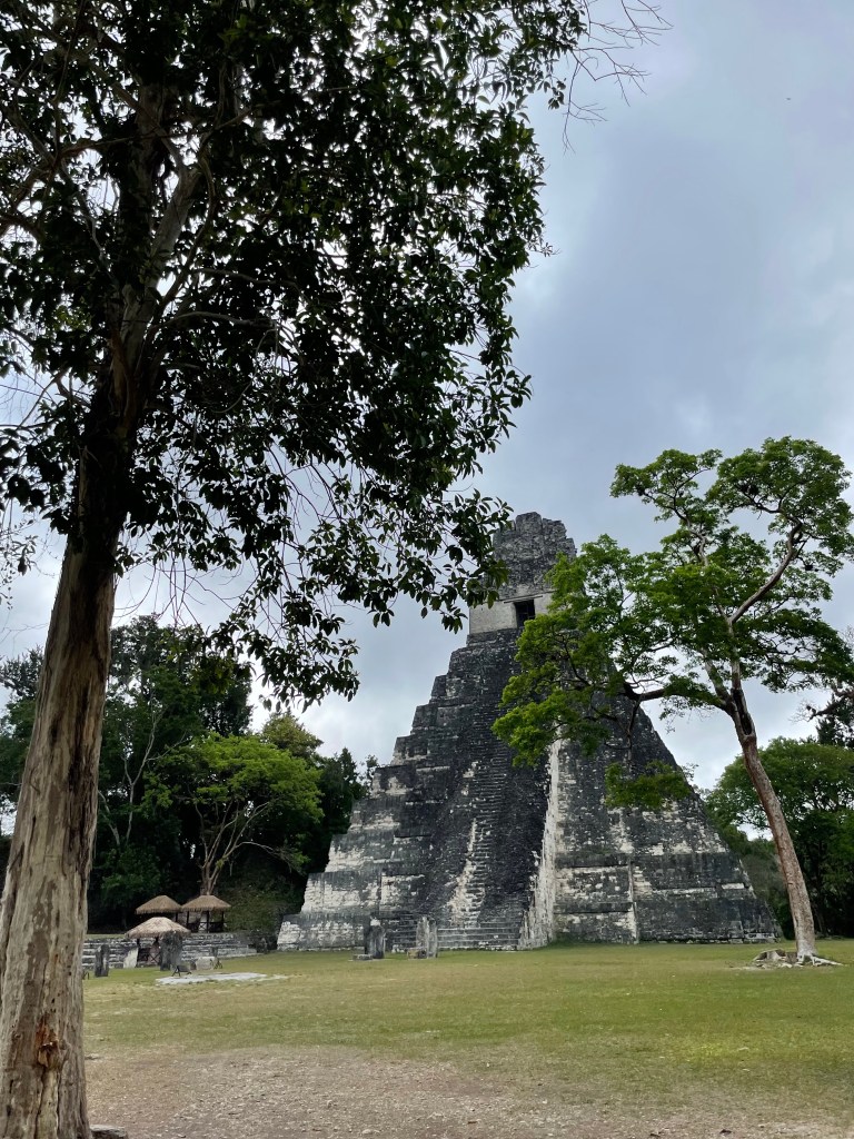
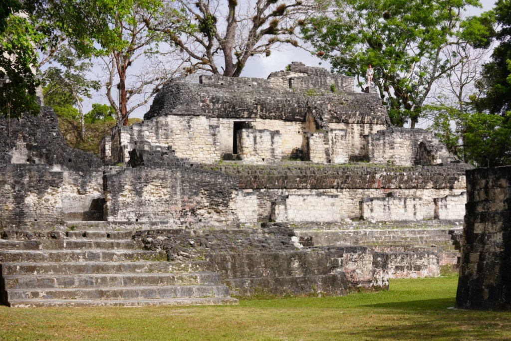
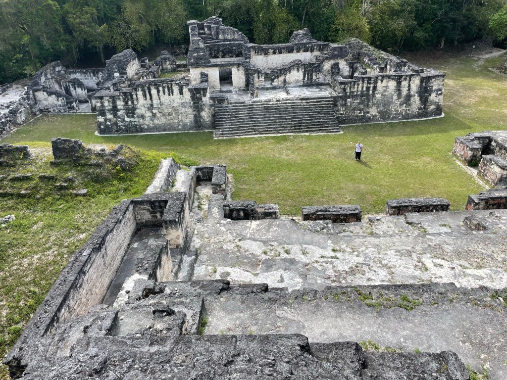
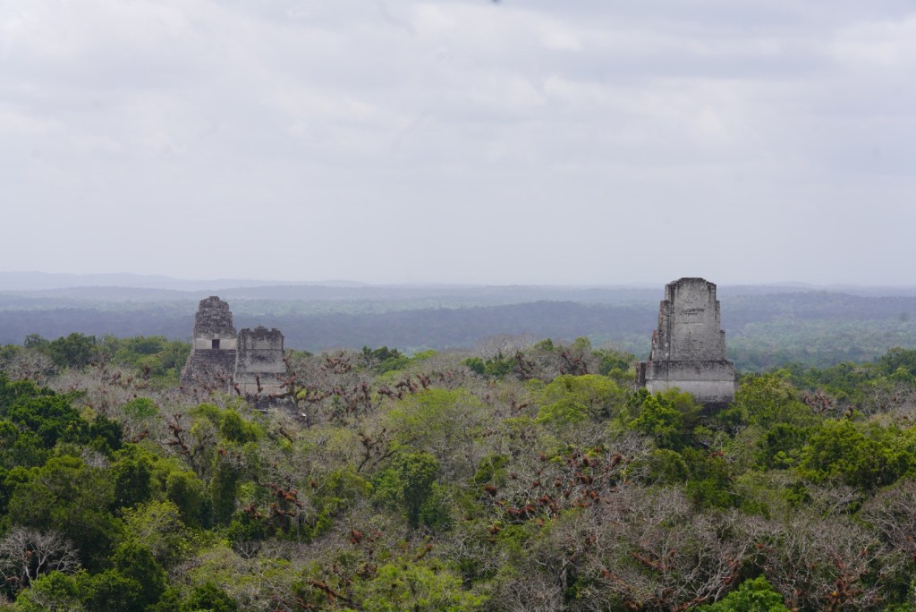
The site’s major structures include five pyramidal temples and three large complexes, often called acropoles; these presumably were temples and palaces for the upper class. One such complex is composed of numerous buildings beneath which have been found richly prepared burial chambers. Pyramid I is topped by the Temple of the Jaguar and rises to 45 metres.
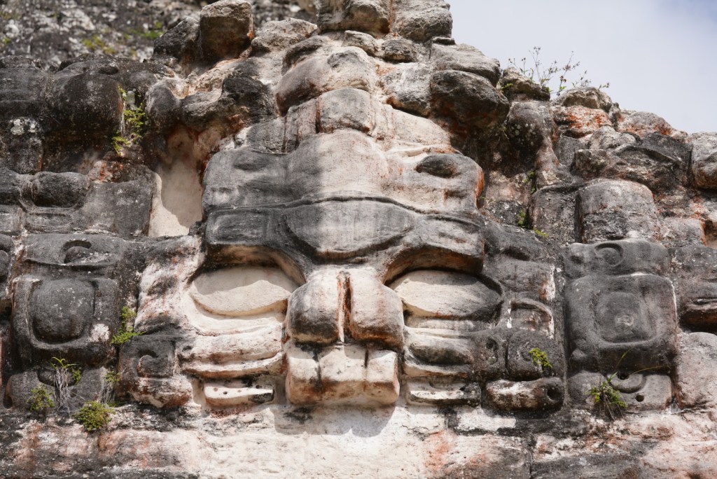
Just west of Pyramid I and facing it is Pyramid II, standing 42 metres above the jungle floor and supporting the Temple of the Masks.
Here we have both.
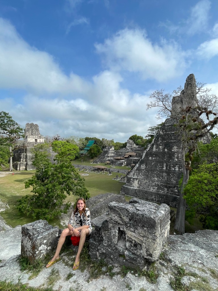
Pyramid III is 55 metres high. Near the Plaza of the Seven Temples stands Pyramid V with 57 metres.
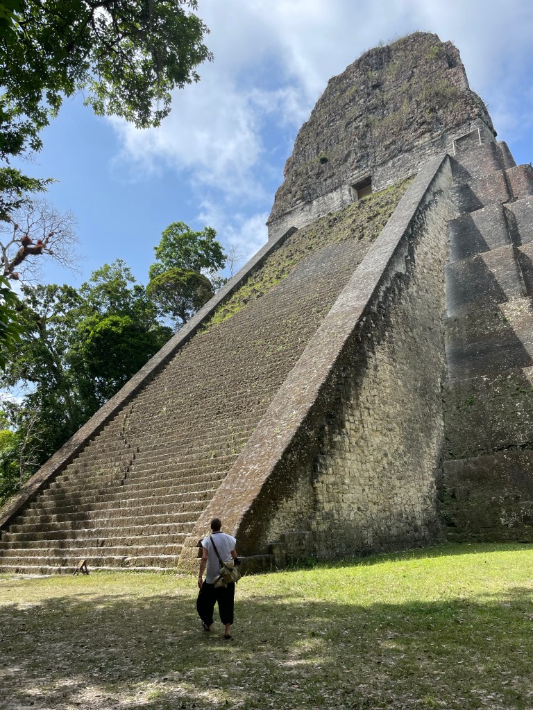
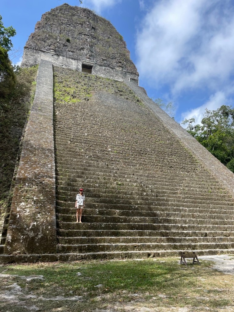
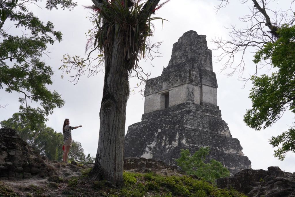
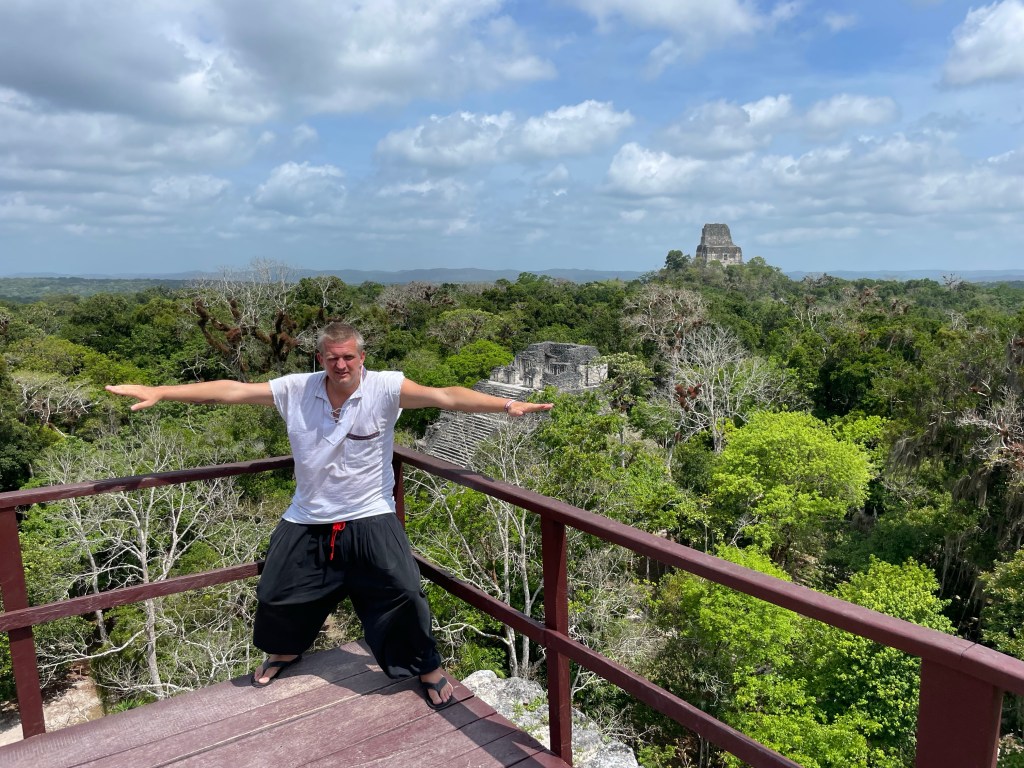
The highest of the Tikal monuments is Pyramid IV 65 metres, which is the westernmost of the major ruins and also the site of the Temple of the Two-Headed Serpent. Pyramid IV is one of the tallest pre-Columbian structures in the western hemisphere.
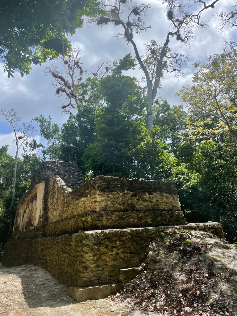
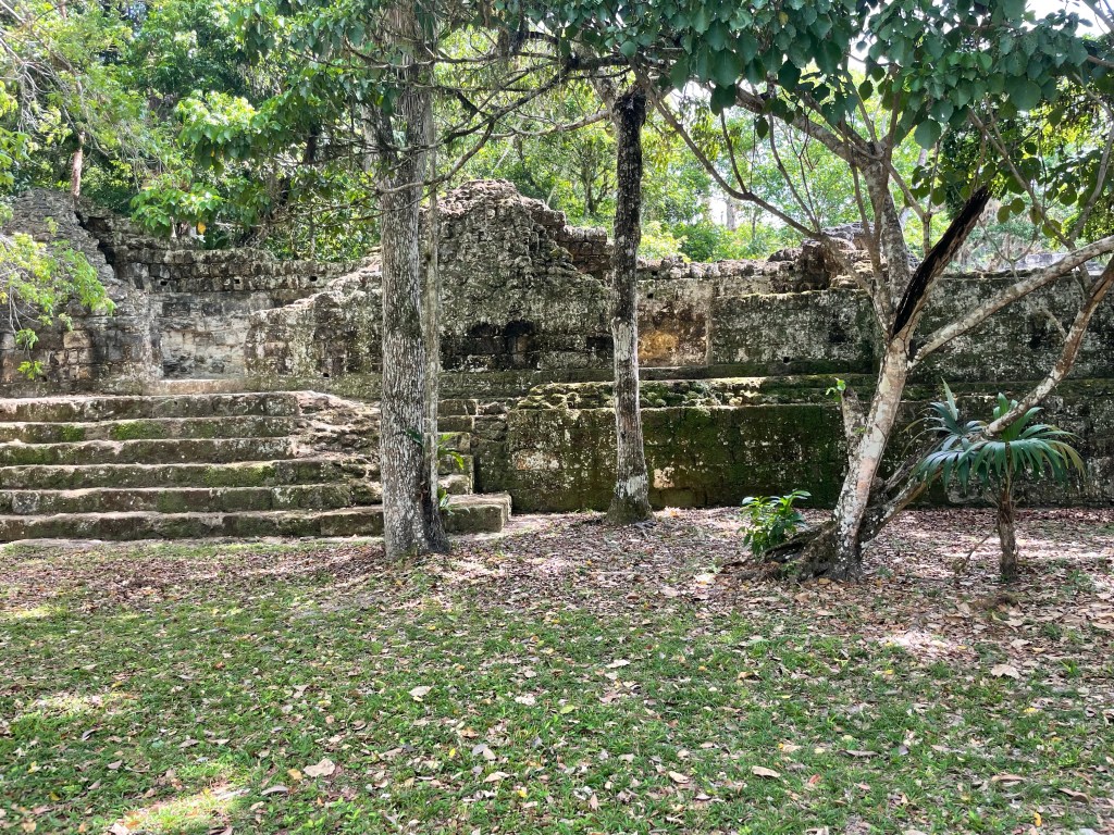
There of course are tons of other structures. Other Pyramids, temples , playgrounds etc etc.
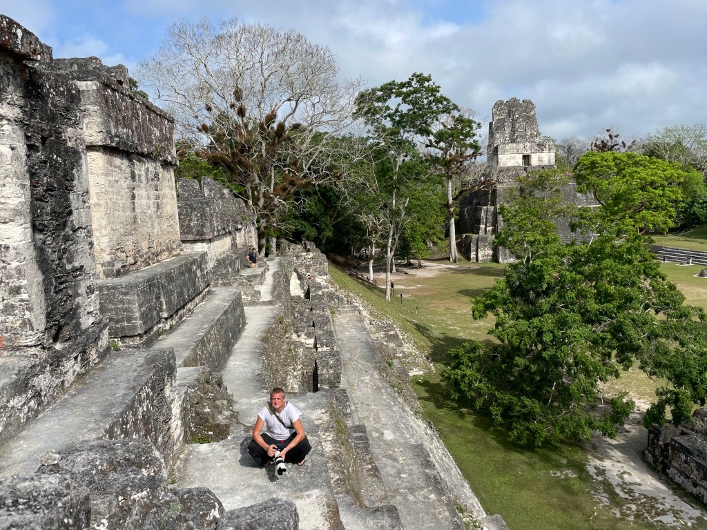
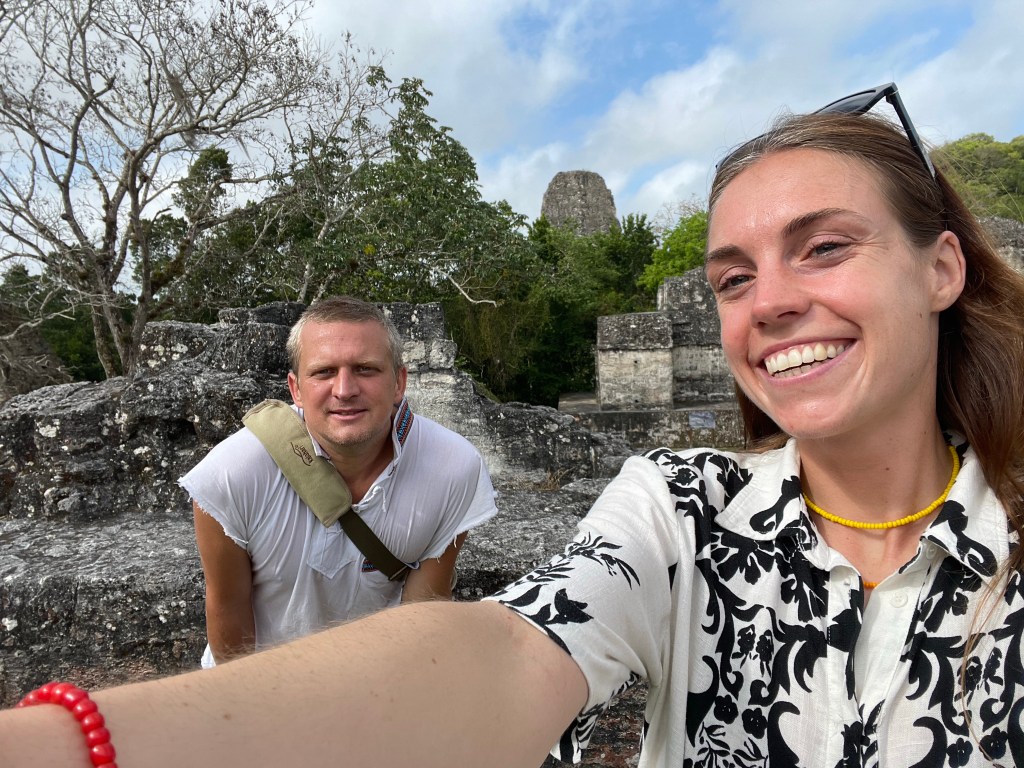
The cool thing was that for hours were alone and could climb around and explore to our hearts content.
In the Temple of Windows we could even get in. Lu was first and scared the bats in there more then they scared her.
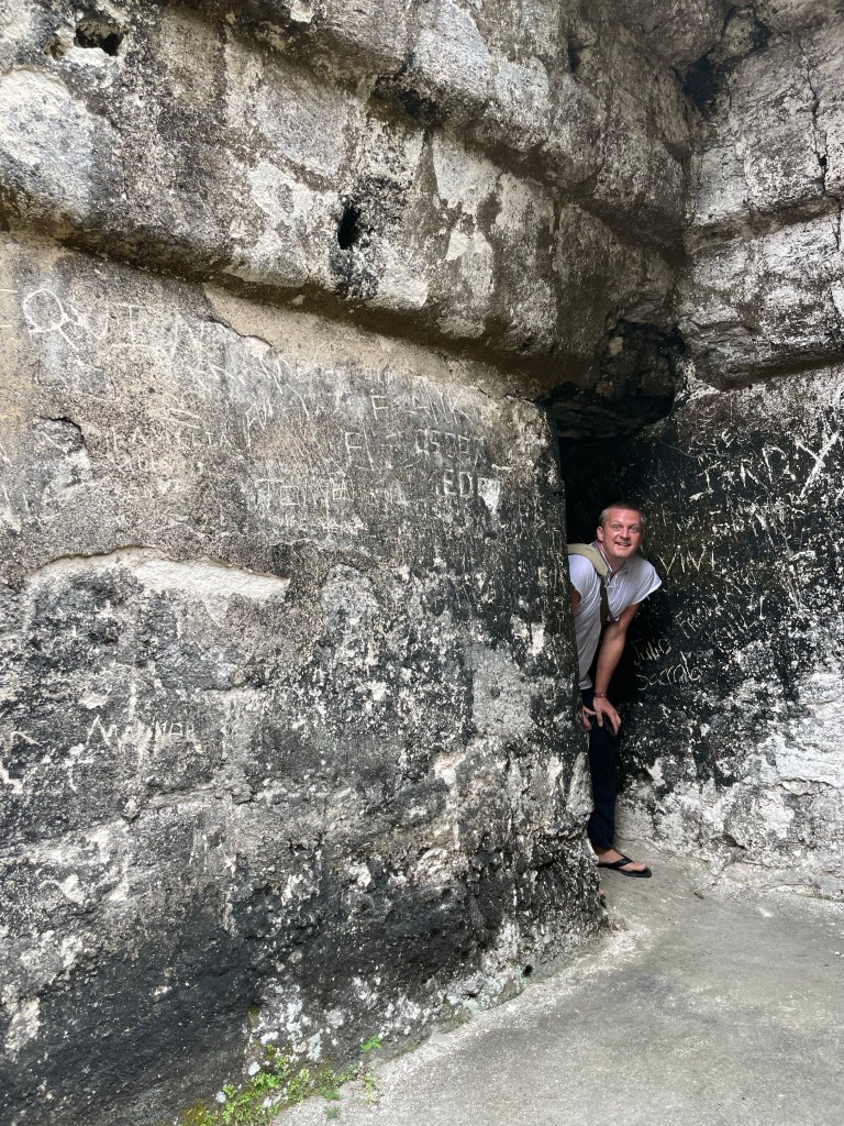
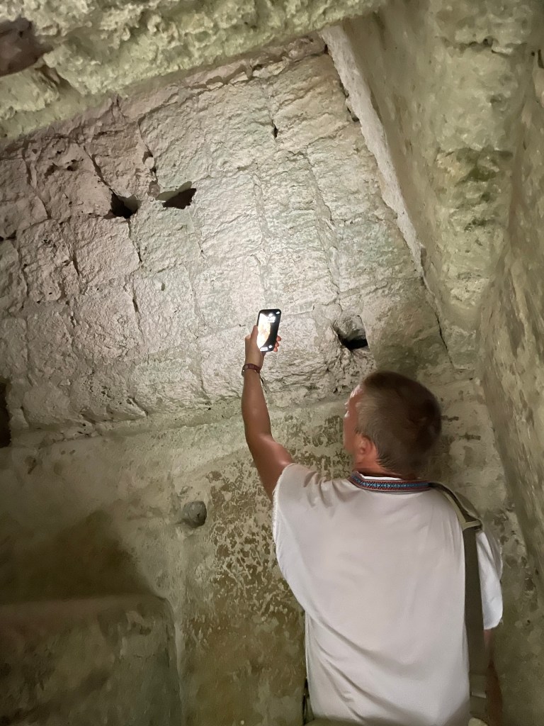
Some of the Temples even had access to the tombs below. We did not go in because these tunnels are tiny, and scary.

It is crazy if you think about that the entire city has a vast tunnel system below it. In a documentary that i watched before coming here they said that the ceilings of these tunnels where covered with minerals to copy the night sky and the stars.The tunnels led to tombs that are symmetrically perfectly aligned to the middle of the towers of the pyramids. Calculating and then building this a couple of hundert years before christ is simply bonkers.
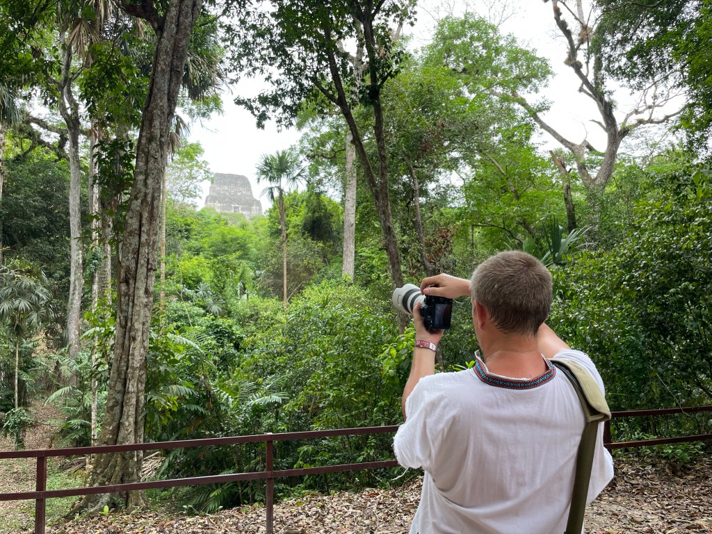
After around 5 hours we decided to clim the highest Pyramid (IV) and have a view from up there.
Another totally bonky wonky fact is that all these ancient cities traded with eachother,Chichen Itza ,Teotihuacan , Palenque etc. We are talking thousands of kilometers by foot, through the jungle,over mountains, in the heat..
What we loved here is that there was no one trying to sell us silly touristy obsidian , jaguar masks or mayan calendars which was the case everywhere else. Especially Palenque we couldn’t hack after a while since every two meters there was a stand.
Anyways if you do come here at some point, and you absolutely should, come early and you will have the place to yourselves.

Leave a comment